Agencies: Find Proximity Cliffs and Fix Them With a Geo-Grid
Published September 30, 2026
Agencies: Find Proximity Cliffs and Fix Them With a Geo-Grid

A geo-grid is a set of Lat/Lng test points spread across a map that you use to check how a business ranks in Google Maps and Google Business Profile results from each location. Instead of one ranking check from your office, you get a full picture of where visibility holds and where it drops off. Most agencies run these scans through rank-tracking tools or the Maps and Places APIs.
TL;DR:
- Geo-grids reveal proximity cliffs and weak zones that single-point checks cannot detect, guiding targeted local SEO efforts.
- Tighter grid spacing captures more detailed variations in urban markets, while wider spacing suits rural areas with fewer competitors.
- Consistent scanning every one to two weeks, especially after profile updates or citation changes, helps track visibility patterns over time.
- Accurate Lat/Lng data and controlled device and locale settings are crucial to ensure valid, comparable results in geo-grid analysis.
- Automated tools like Maprank streamline the process, saving time and providing actionable visualizations of ranking inequalities across a market.
Table of Contents
- What a geo-grid is and how it works in practice
- Why use a geo-grid: use cases that single-point checks miss
- How to build and run a geo-grid step by step
- Reading geo-grid results and turning patterns into fixes
- How geo-grids evolved in local SEO
- Geo-grid versus other rank tracking methods
- Limitations and challenges of geo-grid analysis
- How we run geo-grids and what clients typically see
- How Maprank and Local SEO Bot help
- Sources
- FAQ
What a geo-grid is and how it works in practice
A geo-grid is built from a defined area, a spread of coordinates across that area, and a set of search queries you want tested from each point. Each coordinate acts as a simulated searcher standing at that exact location, running the same query a real customer would type into Google.
Every scan returns a snapshot of data for each point on the grid:
- Whether the business appears in the map pack at all
- The exact ranking position when it does appear
- The distance from that point to the business
- A saved image or record of the pack results at that moment
These outputs map closely to what Google says drives local rankings: relevance, distance, and prominence, according to Google Business Profile guidance. A geo-grid does not measure those three factors directly, but it shows their combined effect at every point you test, which is why two businesses a mile apart can see completely different rankings for the same search term. Results shift depending on how tight your grid spacing is and how Google is currently weighing signals in that specific area, so a scan from last quarter is not a permanent map of your visibility.
Why use a geo-grid: use cases that single-point checks miss
A single ranking check tells you almost nothing about how customers actually experience your visibility, because it only reflects one location at one moment. A geo-grid solves several problems that a spot check cannot touch.
- Spot proximity cliffs. You find the exact point where your ranking drops from page one to invisible, rather than guessing at a general “service area.”
- Compare zones directly. You see how you perform inside your official service area versus just outside it, and how you stack up near clusters of competing businesses.
- Measure the effect of changes. A geo-grid run before and after a Google Business Profile update, a new citation batch, or a review push shows exactly which neighborhoods responded.
- Set priorities with evidence. Instead of guessing where to build local pages or pursue citations, you point resources at the specific zones the grid flags as weak.
How to build and run a geo-grid step by step
Running a geo-grid well is a repeatable process, not a one-time project. Following the same steps each time makes results comparable over months.
Step 1: Define objectives and boundaries. Decide what you are trying to measure: an entire metro area, a handful of neighborhoods, or a fixed radius around a storefront. Vague boundaries produce grids that are either too sparse to be useful or too dense to afford.
Step 2: Pick your grid spacing. Density should match how compact the market is:
- Urban areas: relatively tight spacing to catch block-by-block changes
- Suburban areas: moderate spacing to cover neighborhoods effectively
- Rural areas: wider spacing reflecting sparser competition and larger travel distances
Tighter grids catch more detail but cost more scans and take longer to review. Looser grids are cheaper but can miss a sharp proximity cliff sitting between two points.
Step 3: Choose your method. A dedicated rank tracker with built-in geo-grid support, such as Maprank, handles the scanning and storage automatically. Agencies building custom dashboards sometimes work directly with the Places API’s searchNearby method, which supports location restrictions and a rank preference for distance or popularity. Manual checks by hand only make sense for very small samples, since they do not scale past a handful of points.
Step 4: Set your cadence. Run a baseline scan first, then repeat weekly or biweekly depending on how competitive the market is. Always re-scan after any major change: a new citation batch, a profile edit, or a review campaign.
Step 5: Record consistent data. For each point, log the Lat/Lng, the exact query tested, the timestamp, the rank position, a snapshot of the top pack, and any notes on what changed since the last scan.
- Keep query strings identical across scans so results are comparable
- Run checks in an incognito or logged-out state to avoid personalized results skewing rank
- Control for device type and locale settings, since both can shift what Google returns
Pro Tip: Before you scan anything, confirm your listing’s Lat/Lng is accurate using the manual adjustment options in the Business Profile APIs, since a misplaced pin can create false variation across your entire grid.
Reading geo-grid results and turning patterns into fixes
Once you have a completed scan, the value is in the pattern, not any single point. Three patterns show up repeatedly.
- Stable core area. Rankings stay strong across a tight cluster near the business. This is a sign to protect the win: keep review generation steady and keep the profile complete rather than assuming the work is finished.
- Proximity cliff. Rankings hold near the business, then fall off sharply past a certain distance. Spatial analysis literature describes this kind of non-linear decay as category-dependent, meaning service categories with home visits often see sharper cliffs than destination categories like restaurants. When you find a cliff, prioritize relevance signals first (service area configuration, category accuracy, on-page content), then targeted citations and local landing pages for the zones just past the drop.
- Spotty or outlier wins. Isolated points rank well while nearby points do not, often pointing to a recent profile edit, a burst of reviews, or short-term ranking noise rather than a durable change.
Overlaying reviews density and citation consistency onto your grid helps separate a prominence problem from a relevance or distance problem, since Google weighs all three together according to its own ranking guidance. Measure real improvement by tracking pack share and average rank across the whole grid over time, not by watching one point. Expect visible movement over weeks to months rather than days, and treat a location that never breaks out of a cliff as a signal to reconsider its service-area profile rather than keep pushing the same tactics.
How geo-grids evolved in local SEO
Early local rank tracking relied on a single search from a single location, usually the office address or a data center IP with no way to simulate a customer standing somewhere else in town. That approach missed the fact that Google Maps results change block by block, especially once “near me” search volume grew and mobile location signals became central to ranking.
As agencies noticed rankings swinging wildly between office checks and client complaints from across town, informal multi-point testing began: manually searching from a few different addresses or using VPNs to simulate other locations. That was slow and inconsistent.
The rise of mapping APIs and dedicated rank-tracking platforms turned that manual patchwork into structured grids: fixed sets of coordinates scanned on a schedule, with results stored for comparison over time. Tools built specifically around geo-grid scanning, including Maprank, made this workflow available without custom engineering, and it is now the standard way agencies verify visibility claims instead of relying on a client’s own search results, which are shaped by personalization and search history.

Geo-grid versus other rank tracking methods
Geo-grid scanning is one of several ways to track local visibility, and each method fits a different need.
A single-location rank check, run from one address or IP, is fast and free but tells you nothing about how visibility changes across a service area. It works fine for a business with one tight, small radius and no real competition nearby.
Manual searches from a phone while driving around town give a real-world feel for what customers see, but they do not scale, are not repeatable on a schedule, and depend on personalized results tied to the searcher’s own account and history.
Keyword rank tracking tied to organic web results measures a different thing entirely: traditional search rankings, not the map pack. It matters for content strategy but says nothing about how a business appears on Google Maps.
Geo-grid scanning sits above all three because it is systematic, repeatable, and spatially complete. It costs more in scan volume and setup time than a single check, and it requires more interpretation than a simple rank number, but it is the only method that shows exactly where visibility starts and stops across a market.

Limitations and challenges of geo-grid analysis
Geo-grids are useful, but they are not a complete picture of local search performance on their own. A few limits are worth knowing before leaning on the results too heavily.
Grid results reflect visibility, not conversions. A location can rank well across a wide grid and still lose customers to competitors with stronger reviews or better photos, since ranking position alone does not measure whether searchers choose to call or visit.
Google’s local search radius is dynamic. Denser urban areas tend to produce narrower search radii for the same query than rural ones, which means a grid spacing that works well in one city may need adjusting elsewhere.
Geocoding accuracy also matters more than most people expect: if a business’s listed Lat/Lng does not match its real address precisely, scans can show false variation that has nothing to do with actual ranking performance, according to Google’s developer documentation on manual location adjustment. Running scans without a clear objective, treating them as passive monitoring rather than a tool tied to specific fixes, wastes the effort geo-grids are meant to save.
How we run geo-grids and what clients typically see
Geo-grid tracking through a dedicated rank tracker runs alongside manually built premium citations rather than automated citation blasts. That pairing lets users see, point by point, whether a citation push or profile fix actually moved rankings in the neighborhoods that needed it.
Clients typically see the clearest movement within weeks of a citation and profile correction, though timelines vary by category and competition density. Geo-grids show where visibility exists, not whether a searcher picks up the phone, and outside factors such as a competitor’s new listing or a review surge can shift a grid regardless of what a business changes.
— Local
How Maprank and Local SEO Bot help
Building and reading a geo-grid by hand, point by point, takes real time every week. Maprank automates that entire workflow: it runs scheduled scans across your grid, stores every point’s rank position and pack snapshot, and shows you the proximity cliffs and stable zones without a spreadsheet.
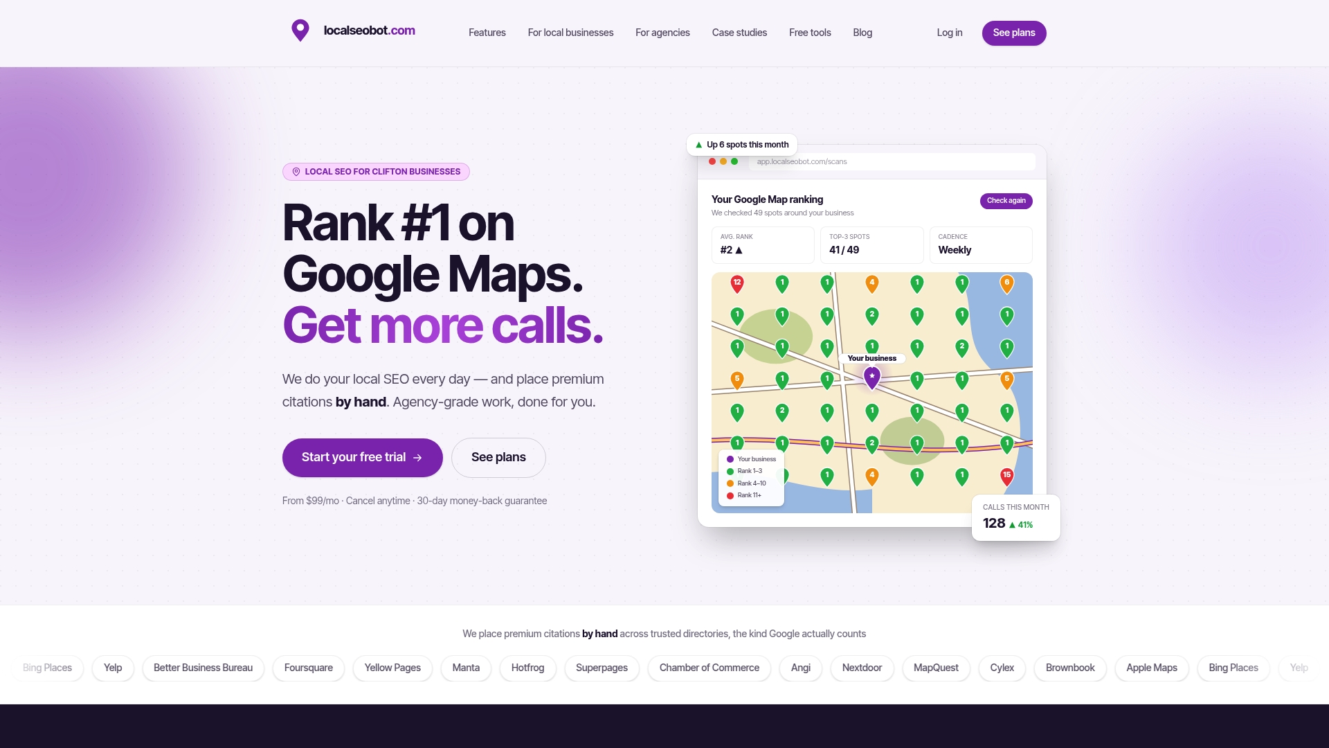
Local SEO Bot pairs that tracking with manually built premium citations on high-authority directories, so the fixes your geo-grid points to actually get done rather than sitting on a list. The service is offered with a 30-day money-back guarantee if Google Maps rankings do not improve.
- Start tracking with Maprank’s geo-grid rank tracker
- Compare plans on the pricing page, which offer tiered options catering to different user needs
- Agencies managing multiple client locations can review white-label Pro pricing which offers advanced features
Sources
For readers who want to verify the mechanics behind geo-grid scanning:
- Tips to improve your local ranking on Google - Google Business Profile Help
- Method: places.searchNearby | Places API | Google for Developers
- Feature concept: Spatial decay / proximity cliff - GISTBoK
For sharpening the competitive side of your grid analysis, this SEO competitor analysis guide covers workflow that complements grid findings.
FAQ
What does geo-grid mean in local SEO?
A geo-grid is a set of geographic coordinates spread across an area, each used to test how a business ranks in Google Maps results from that specific spot. It replaces a single ranking check with a full map of visibility across neighborhoods or a service area.
How do geo-grid settings affect scan accuracy?
Grid spacing controls how much detail a scan captures: tighter spacing in urban areas catches block-by-block changes, while wider spacing suits rural markets with less competition. Getting the Lat/Lng of the business listing itself correct matters just as much, since inaccurate geocoding can distort results, per Google’s developer guidance.
What is a proximity cliff in geo-grid results?
A proximity cliff is the point on a geo-grid where ranking visibility drops sharply once a searcher’s location passes a certain distance from the business. Spatial analysis research notes this decay is category-dependent, with service businesses that travel to customers often showing steeper cliffs than storefront destinations.
How often should you run a geo-grid scan?
Most businesses benefit from an initial baseline scan followed by scans every one to two weeks, with an extra scan after any major change like a new citation batch or profile edit. Highly competitive markets often justify more frequent checks than low-competition rural areas.
Can Maprank replace manual geo-grid tracking?
Maprank automates the scanning, storage, and pattern review that a manual geo-grid workflow otherwise requires by hand. It is built specifically to run scheduled scans across a defined grid and surface ranking patterns like proximity cliffs without a spreadsheet, though pricing and setup depend on the plan chosen from Local SEO Bot’s pricing page.